How to Navigate the Florida Intracoastal Waterway (ICW)
Florida’s Intracoastal Waterway (ICW) is a monumental feat of engineering achievement that runs from Boston, Massachusetts, around Florida, and over past Corpus Christi, Texas. This 3,000-mile inland waterway is made up of natural inlets, saltwater rivers, bays, sounds, and man-made canals. If you were so inclined, you could travel the entire length, with a few necessary detours, without ever having to venture out into the open ocean. That’s how incredible this system is!
Want to boat along the coastlines of Florida? Here are a few things you need to know first, this is How to Navigate the Florida Intracoastal Waterway:
- Intracoastal basics
- Navigating the Atlantic Intracoastal Waterway (AICW)
- Navigating the Gulf Intracoastal Waterway (GICW)
Discover available boat rentals in Florida
Intracoastal basics
The current route of the Intracoastal is technically made up of three non-continuous sections that run along the whole length of the route. The first major section, the Atlantic Intracoastal Waterway (AICW), runs from Portsmouth, Virginia, to Key West, Florida.
The Florida section of this begins around St. Mary’s River near the Georgia/Florida state line. Things can begin to get tricky while navigating the Intracoastal in Florida. The next section of the Intracoastal is a section of the Gulf Intracoastal Waterway (GICW), and it picks up on the west coast in Punta Rassa, Florida, extending all the way to Tarpon Springs, Florida.
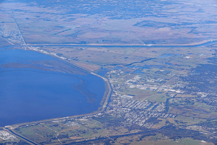
To connect these two sections, you will have to navigate other waterways outside of the Intracoastal. The Okeechobee Waterway is the only true cross Florida canal, and it connects Stuart, FL on the east coast with Fort Myers, FL on the west coast. This allows you to come down the eastern AIWW, cut across the state, and pick up the Gulf Intracoastal at Punta Rassa near Fort Myers.
The alternative to this is a trip down through the Keys, around the tip of Florida, and up towards Punta Rassa. From Punta Rassa, you can follow the Gulf Intracoastal to the Anclote River near Tarpon Springs, FL. The route cuts off here again and leaves you to navigate 140 nautical miles of open water passage before rejoining the Gulf Intracoastal near Carrabelle, FL.
To successfully navigate each section of the Intracoastal, there are certain things you need to know. You need to understand the aids to navigation, such as buoys and markers. Knowing what to look for will keep you on track, it is very easy to take a wrong turn. You’ll also need to know other navigational information like charts to use and major communication channels.
For recreational boaters with larger vessels, like sailboats, you’ll need to know about bridges and powerlines ahead of time. Similarly, it is very helpful to know about the tides. We’ll cover this information in the next sections for the Atlantic and Gulf Intracoastal sections, respectively.
Explore available boat rentals in Fort Myers, FL
Navigating the Atlantic Intracoastal Waterway in Florida
The Atlantic Intracoastal Waterway (AICW) begins in Florida near St. Mary’s River at the Florida/Georgia state line. You travel in a south-south easterly direction from there and transition to a southwesterly course as you pass through the Government Cut of Miami.
You’ll eventually reach Cross Bank near Plantation Key, and this marks the official terminus of the AICW. If you need to travel faster and save time on the journey, you should deviate from the AICW at Government Cut and use Hawk Channel instead.
AICW: Buoys & markers
The buoys and navigational markers for the Intracoastal Waterway are almost identical to any other in the United States. The key difference is that ICW passages have reflective yellow squares and yellow triangles added to the markers. Pay close attention to these!
Because the ICW follows the shoreline and intersects several major waterways, the rule “red, right, returning from seaward” can quickly become confusing. The colored navigation aids may switch sides in some places, so, to keep track of your direction, have good pair of binoculars nearby to spot the small reflective yellow squares and triangles along the ICW.
While the yellow squares are usually found on green buoys and beacons and the yellow triangles are typically found on the red ones, this isn’t always the case. The rule to follow when navigating the ICW is as follows:
As long as you follow those basic rules along the Intracoastal, you’ll manage navigation. You will notice several other types of signs and markers, though. The ICW uses mile markers, for example, measured in statute miles (= 5,280 ft) instead of nautical miles (= 6,076 ft).
These little white signs with black numbers can become confusing since boats measure their speed in knots. Conversion tables are available, though, to help make things easier.
You can also expect to see range boards along some sections of the ICW. These large rectangular dayboards are painted with three vertical stripes, and they are put in place where cross currents and shallow waters are a problem. These range boards come in pairs, and your goal is to keep the front one lined up just below the back one.
While navigating the ICW stay on the lookout for any navigational aids that are lit up. Illuminated aids are there for a reason. These lights are usually there to call attention to a hazard or the need for a quick turn. Some will be blinking quickly, and that usually means you need to make a quick turn there.
READ MORE: Top 5 Florida East Coast Beaches
AICW: Charts, channels, & communications
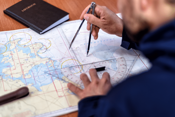
Although the Intracoastal is well-marked, you will still need the right charts and methods of communication to keep you on the appropriate heading. You will also need to know channel depths depending on the size of your vessel.
The National Oceanic and Atmospheric Administration (NOAA) provides excellent navigational charts to search by location name or chart number. You can buy the same charts through Amazon printed on water-resistant paper or print them out yourself and laminate them.
The essential charts for the AICW are #11489, #11485, #11472, #11467, #11451, #11445, and #11446. These charts, in this order, map your entire route along the Atlantic Intracoastal. Remember, mileages on the AICW are marked in statute miles which increase from St. Marys River in the north (MM “713.7”) to Plantation Key in the south (MM “1153.4”).
Pro tip: The channel depths along the AICW can change due to shoaling.
From St. Marys River to Ft. Pierce, the federal project depth calls for 12 feet; from Ft. Pierce to Miami, it should be 10 feet, and from Miami to Cross Bank expect 7 feet. Still, keep an eye out for drop aids left by the Coast Guard. These temporary navigational aids are dropped in shoaling areas and will indicate where you need to give a wide berth.
Pro tip: For bridges and other potential hazards, you can use VHF Channel 09.
AICW: Bridges, locks, & power lines
Because the Intracoastal follows the shoreline so closely and uses rivers, inlets, and other channels, the numerous bridges, locks, and power lines along the Florida coast can become a problem for some vessels. For the entirety of the Intracoastal Waterway, the official overhead clearance is 65 feet above the mean water height. However, for the Florida section of the Atlantic Intracoastal, there is an exception.
The Julia Tuttle Bridge in Miami has a fixed clearance of 56 feet. Southbound vessels that exceed that height have to exit the AICW around Port Everglades and reenter after Government Cut, Miami.
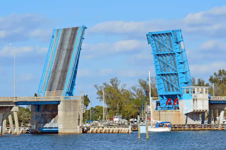
Overall the Intracoastal features six distinct bridge types. You will see fixed, lift, single-bascule, double-bascule, single-pivot swing, and double-pivot swing bridges. Fixed bridges are, as the name implies, fixed. You don’t have to worry about these as long as your vessel isn’t too tall. The other bridges, however, can pause your progress if you come at the wrong time. These bridges need to be lifted or swung open to allow passage for most vessels. There are hours when a bridge will not open; but, as a rule of thumb, use the local bridge channel to hail the bridge.
In Florida, the VHF for bridges is channel 09. Whether you intend to pass through the bridge or not, always hail them to indicate your intention. There is nothing more annoying for a bridge tender than trying to guess if the boat speeding towards them is planning to stop and turn or not. Along the AICW bridges will be one of your biggest navigational concerns. There are no locks you need to worry about, and all the overhead power lines have a minimum clearance of 80 feet or more.
Pro tip: If you are ever unsure about clearance or certain aspects of navigation, a commercial vessel is usually not far off that knows how to navigate the area. You can watch them.
AICW: A Note on the tides
The east coast of Florida has semidiurnal tides from St. Mary’s River down to Plantation Key. Once you pass Plantation Key, the tides become mixed-semidiurnal with unequal high and low tides every 24 hours and 50 minutes. The further south you travel from St. Marys, the more the tidal range decreases. You’ll have tides of 5.8 feet near St. Mary’s River and only 1.3 feet near Key West.
Pro tip: Expect equal low and high tides every 24 hours and 50 minutes!
Navigating the Gulf Intracoastal Waterway in Florida
On the western coast of Florida, you have the Gulf Intracoastal Waterway (GICW). It begins at San Carlos Bay near Punta Rassa (MM “0.0”) and runs in a northerly direction. After an initial 150 miles, the first section of the GICW cuts off near Anclote Key near Tarpon Springs (MM “150.0”). From there, you have to navigate 140 NM of open passage before you can rejoin the GICW near Carrabelle, FL (MM “376.0” EHL). The Intracoastal continues along the Florida panhandle and onwards to its terminus at the Port of Brownsville, TX.
GICW: buoys & markers
Navigational aids along the GICW are the same as they are along the AICW. This means that as you head northbound and ultimately westbound, you should follow the same navigational rules as before with the yellow stickers: Always keep the yellow squares to port, and always keep the yellow triangles to starboard. As long as you follow this rule and pay attention to the other navigation aids mentioned for the AICW, cruisin’ should be easy breezy.
GICW: Charts, channels, & communications
The Gulf Coast portion of the Intracoastal is well mapped along its entire length. For the Florida portion of the GICW, you will need to know these NOAA charts:
- #11427
- #11425
- #11416
- #11411
- #11404
- #11402
- #11393
- #11390
- #11385
- #11378
- #11374
This chart range covers the entire Gulf Coast of Florida and can be used to navigate the 140 NM stretch between the two sections of the GICW. One important difference from the AICW occurs when you reach the second section of the GICW. The section is still measured in statute miles, but it is done relative to Harvey Lock near New Orleans, LA (MM “0.0”). This section of the GICW is measured east (EHL) and west (WHL) of Harvey Lock.
The channel’s federal project depth throughout this second section of the GICW is set at 12 feet, while the first section is set at 9 feet. Actual depths can be very different, though, so keep an eye out for drop aids and other indicators. Communications along the GICW still rely on VHF channel 09 for bridges when you are in Florida. As you pass Tampa, things can be a little hectic, so the USCG Vessel Traffic Service there is 156.600 MHz (Ch. 12).
GICW: Bridges, locks, & power lines
Along the entirety of the GICW, there are around 80 bridges. Several fixed bridges offer a clearance of 65 feet or greater, but Florida offers some exceptions. There are three bridges with fixed clearances of 50 feet. These are the DuPont Bridge near Panama City, FL (MM “295.4 EHL”), the Brooks Bridge near Ft. Walton Beach, FL (MM “223.0 EHL”), and the Navarre Causeway Bridge near Navarre, FL (MM “206.7 EHL”).
Most private vessels won’t have to worry about crossing under these bridges.
The Gulf Coast section of the Intracoastal also has seven locks, but they are all located outside of Florida. There are five in Louisiana and two in Texas. Power Lines are also not a problem along the Florida waterways. All the overhead power lines along the GICW have an overhead clearance of at least 80 feet. For the most part, cruising along the Gulf Coast is pretty straightforward.
GICW: A Note on the Tides
Tides along the Gulf Coast are deceptively annoying. The tidal range only varies from around 1 to 3 feet along the length of Florida and doesn’t exceed 2 feet past there. The annoyance comes with the variability of the tides themselves. There are large sections of mixed tides along the Florida Gulf Coast with two unequal high tides and two unequal low tides each day.
As you approach the panhandle, these mixed tides become more semidiurnal with two highs and two lows. Further, along the panhandle, those semidiurnal tides then transition into diurnal tides.
Scoping Out the Intracoastal
If you are considering a long journey along the Intracoastal waterway, you might want to explore the route by land first. The ICW tracks the shoreline pretty closely, so some people have driven and even walked along the length of it. Because of the commercial significance of the route, it is usually well maintained, and there is plenty of information online about bridge schedules or other navigational issues.
As is usually the case, it is best if you can talk to an experienced captain who has recently navigated the ICW. The bigger your boat is, the more important this becomes. Minimum clearance heights, bridge names, and channel depths can seemingly change overnight. This is especially true around Florida, where urban development never ceases.
The Intracoastal offers the kind of adventure that every boater dreams of. There are convenient refueling points, long stretches of uninterrupted nature, waterfront properties, fine cruising speeds, and well-maintained routes. With a decent boat and some prior experience on the water, you can take to the Intracoastal and see for yourself just what it has to offer.
Explore water-travel destinations! Find your next trip at Destination guides and other boating resources here.
About us
Boatsetter is a unique boat-sharing platform that gives everyone—whether you own a boat or you’re just renting—the chance to experience life on the water. You can list a boat, book a boat, or make money as a captain.
List. Earn. Share—Only at Boatsetter

Boatsetter empowers people to explore with confidence by showing them a world of possibility on the water. Rent a boat, list your boat, or become a Boatsetter captain today.
