How to Read a Boat GPS
Last Updated on May 19, 2022 by Boatsetter Team
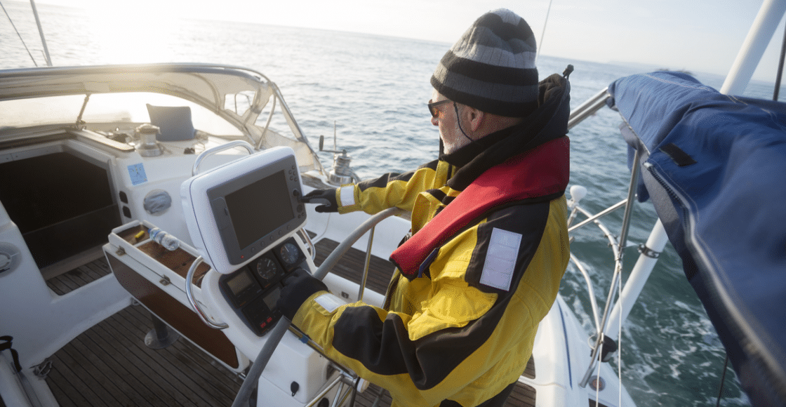
If you’re taking your boat rental into unfamiliar waters, a boat GPS is an essential piece of kit to help you navigate the waters. Before you head out on any boating adventure, you should plan where you are going and what you will do on the water. It’s best to have some idea of where you will head to before you set off so that you can chart your way around the water and not get lost. Navigating on the water is different from navigating on land. First of all, there are no signs to tell you where to go, and there is often a lack of landmarks that make it harder to work out your location. That’s why GPS is an essential tool for you to make your way around the water safely!
Traditional Modes of Navigation
Before the widespread use of GPS technology, more traditional methods were used. These methods are still applicable today and are taught to trainee sailors worldwide to navigate their ship safely should some of their modern navigation equipment fail. If you are using a larger boat rental, various pieces of equipment can be found on the boat to aid you in navigating.
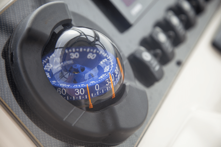
The most important piece of navigation equipment is the compass. A compass is the bread and butter of any type of navigation wherever you are in the world. Learning how to use a compass to find your way around is as essential for mountaineers as it is for sailors. If you know how to use a compass correctly, you can always work out a way to your destination. Your GPS has an inbuilt compass in its system, but you should also find a manual one on board, or if, not it is always great to have one installed on your phone.
Your boat rental should also have local charts from which you can navigate the compass if the GPS fails. To plot a course on the navigation chart, you use parallel rulers to ‘march to different points to plot a course for your boat to sail on. Once you change to a different plot, you can work out the compass bearing that you will need to get to the next one. From here, you use dividers to work out the distance between points, so you know exactly when to turn. These analog tools are installed on a GPS device, and to fully use them is a different story. So, for now, read on about how to use your boat rental’s GPS!
What is GPS
GPS technology has revolutionized how we navigate boats. No longer do you need thorough training in navigation systems, and now instead, you can learn the basics very quickly. This has opened up boating to everybody. If you can learn how to use a GPS, then as a beginner, you can sail and explore various bodies of water, providing the weather and sailing conditions are good. A simple read-up on how to use GPS and then some basic practice shall allow you to explore various bodies of water and then return to the marina with relative ease.
The map displayed on your GPS is referred to as a chart in mariner-related terms. An electronic chart or GPS shows the position of your boat in real-time as well as the direction of travel, speed, and much more. When you first load up your boat rental’s GPS system, it may seem a little bit overwhelming to begin with, but once you click around, it is actually fairly straightforward. It’s always best to ask the boat owner to explain their GPS unit before you head out so you don’t run into any complications once you’re moving. Although GPS systems can differ, let’s now look at how all of them essentially function when used on a boat.
How to use a Boat GPS
The basics of using your boat GPS are pretty straightforward. It is likely to be displayed on a computer screen, and you’ll often have a mouse to navigate your way around it. Firstly use this cursor to select a waypoint on the map that you would like to reach. This shall calculate a waypoint for your boat to follow to reach your destination. If it doesn’t have a cursor, then your GPS may be touch screen operated, in which case you put your finger on the waypoint of the map you would like to go to.
Now hit the ‘go’ button to confirm this as your route. Your GPS should display a compass on the screen for you to follow. If it is your first time doing this, keep the engine tilling slowly and steer your boat from side to side so that you can test out this function to get the hang of it. Once you’ve figured out that the compass changes direction depending on how you steer the boat, it is now time to follow the course that has been charted properly.
You will see on the chart different checkpoints that you must reach on the screen and at which point you shall turn the wheel to change the direction of the boat. Take your boat to each of these checkpoints in as straight a line as possible. There is no need to constantly move the wheel and rock the boat side to side. You can tell how straight you are sailing by looking beyond the stern at the streamline of the foaming water left behind of your boat. If it is straight, then you are sailing straight; if it’s wonky, then you’re not. They often say that you can tell how good a sailor is by how straight the streamline is to the rear of their boat.
Take a look at your GPS chart as you sail forward. You should see that your boat’s position is gradually changing as you move and that you are beginning to reach your first checkpoint. When you approach your first checkpoint, now is the time to change direction. You’ll notice the on-screen compass changes the way it is pointing for you to follow. Steer your boat slowly in this direction until you notice that the direction is now aligned to the compass. Drive forward a little bit more and make any adjustments should the compass stray to the side so that you can keep it aligned.
There you go, you’ve completed the first basic step in using your boat’s GPS unit. Now follow it on to the next successive checkpoints until you have reached your destination. By using the cursor, you can edit the position of these checkpoints if you think that you can work out a faster or more scenic route or any obstacles in the way.
Regarding obstacles, you cannot focus all of your attention on the screen of your GPS. Instead, use it as a guide you refer to at various times, and don’t stare at it as you sail. You should stay alert for any upcoming obstacles that may be in your way, especially in busy boating areas where another vessel can stray into your path suddenly.
You must also make sure that you stay above your boat’s maximum depth and not run aground. The distance of your boat from the ground should be displayed on your GPS screen to make sure that you keep your boat above its maximum level, particularly if it is a bigger boat. These boats are more challenging to navigate in tighter situations and, in general, require a greater distance from the ground. Additionally, these boats shall suffer more damage should they touch the ground, and you may find yourself in a precautions situation should they do so.
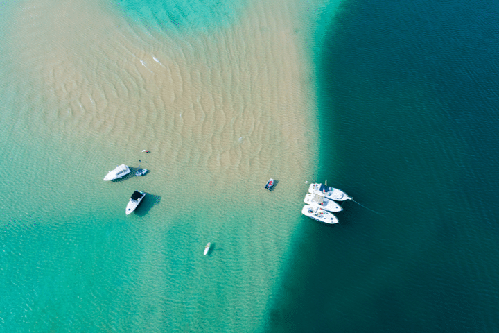
Luckily your GPS should pop up a warning sign should your boat be or about to be in shallow water. If you click around on the chart, you will see the estimated water depth to know well in advance how deep the water is before you reach it. In addition to this, you should try not to get too close to the coastline. Sandbanks and rocks are more common here and can easily sneak up on you. Your boat’s GPS system does not always pick these up, so you need to keep a careful eye out for them.
If you are on a smaller boat rental, it may not come equipped with any marine GPS system. If these are unfamiliar waters that you are heading into, then there is no need to be concerned, as there are GPS boating apps specifically designed for boating that you can download. At Boatsetter, we like to use Navionics to navigate our boats, sometimes even when there is already a navigation system onboard! Here are a few other boat-related apps that boat lovers shouldn’t be without!
It’s easy to learn how to use a GPS and hard to forget once you know. By following our guide, you can be confident in getting the gist of it. Nothing beats experience, though, so book your boat rental and get out onto the water to learn a new skill. Here’s a short video so you can also get a visual explanation on how to read a boat GPS!

Boatsetter empowers people to explore with confidence by showing them a world of possibility on the water. Rent a boat, list your boat, or become a Boatsetter captain today.
